Brian Pellican Murphy
Environmental Scientist specializing in GIS, remote sensing, and cartography.
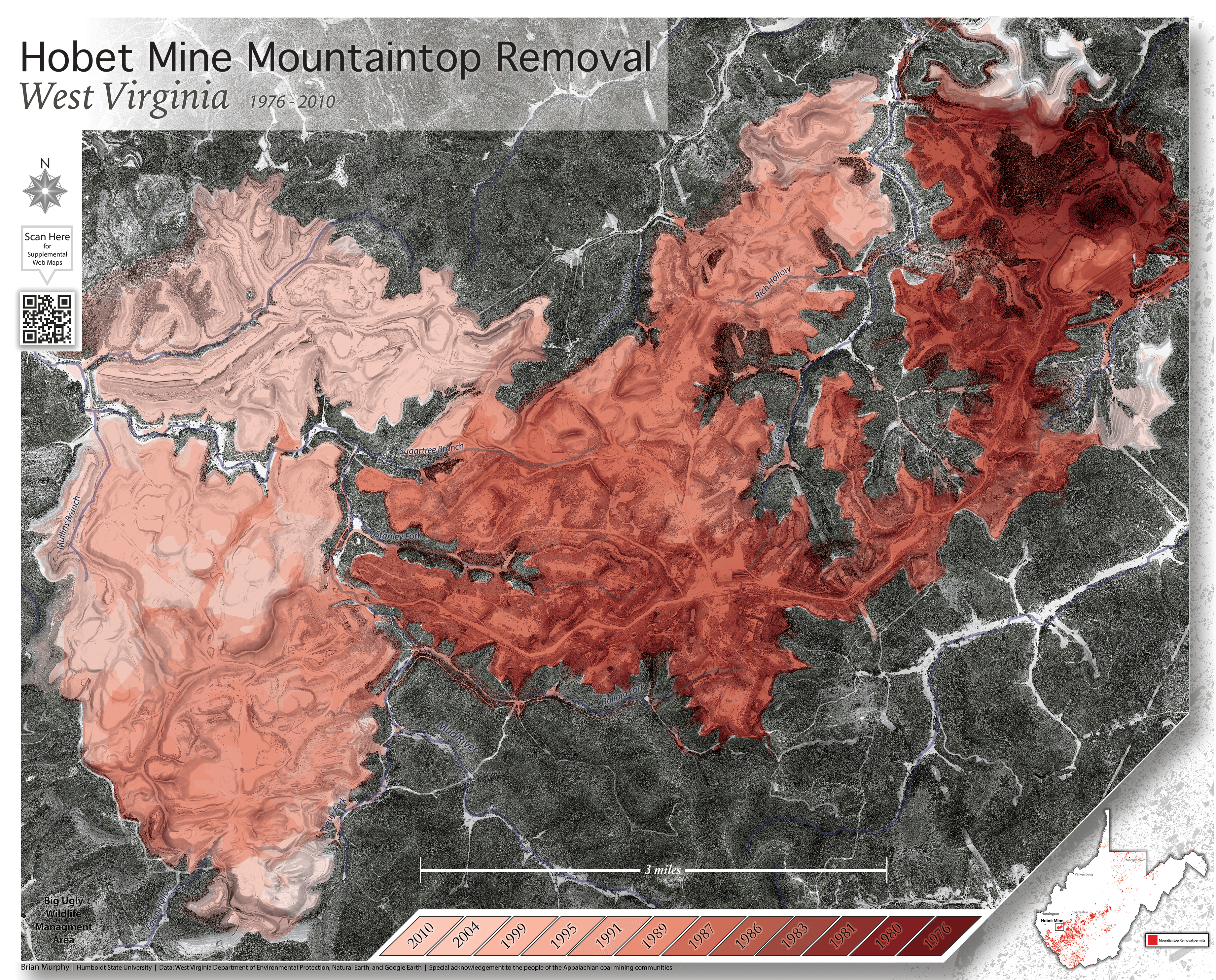
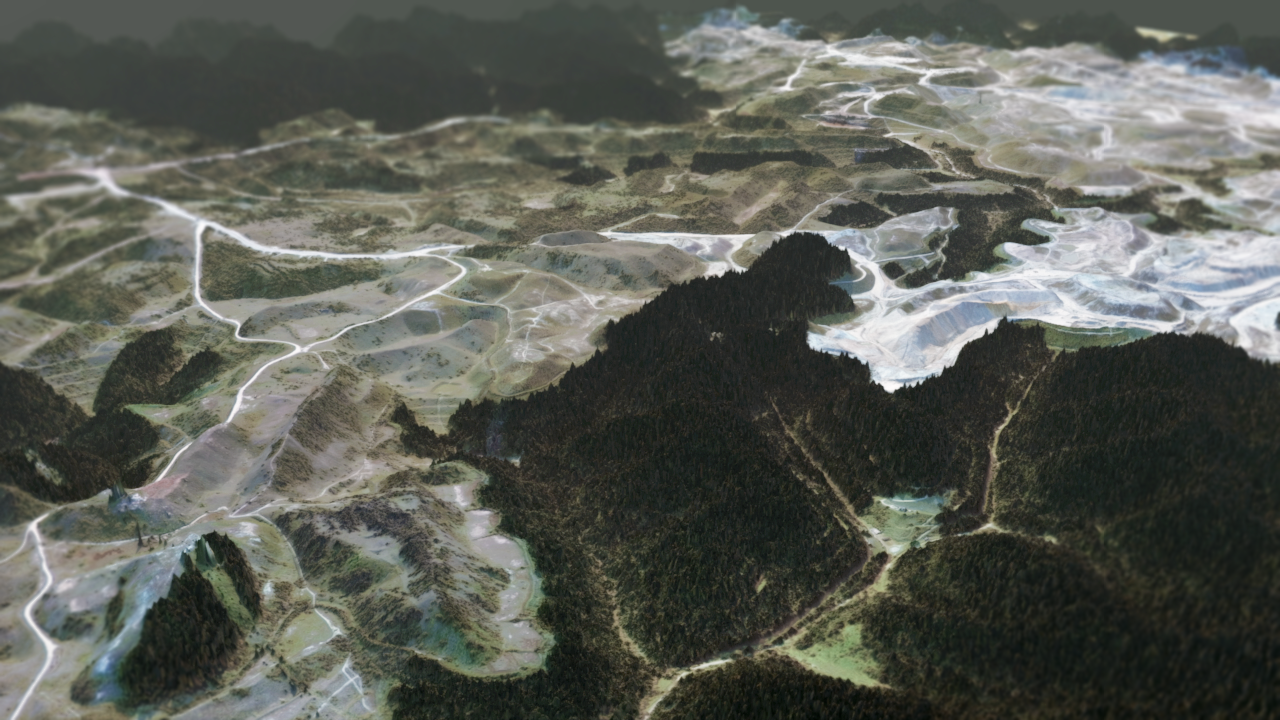
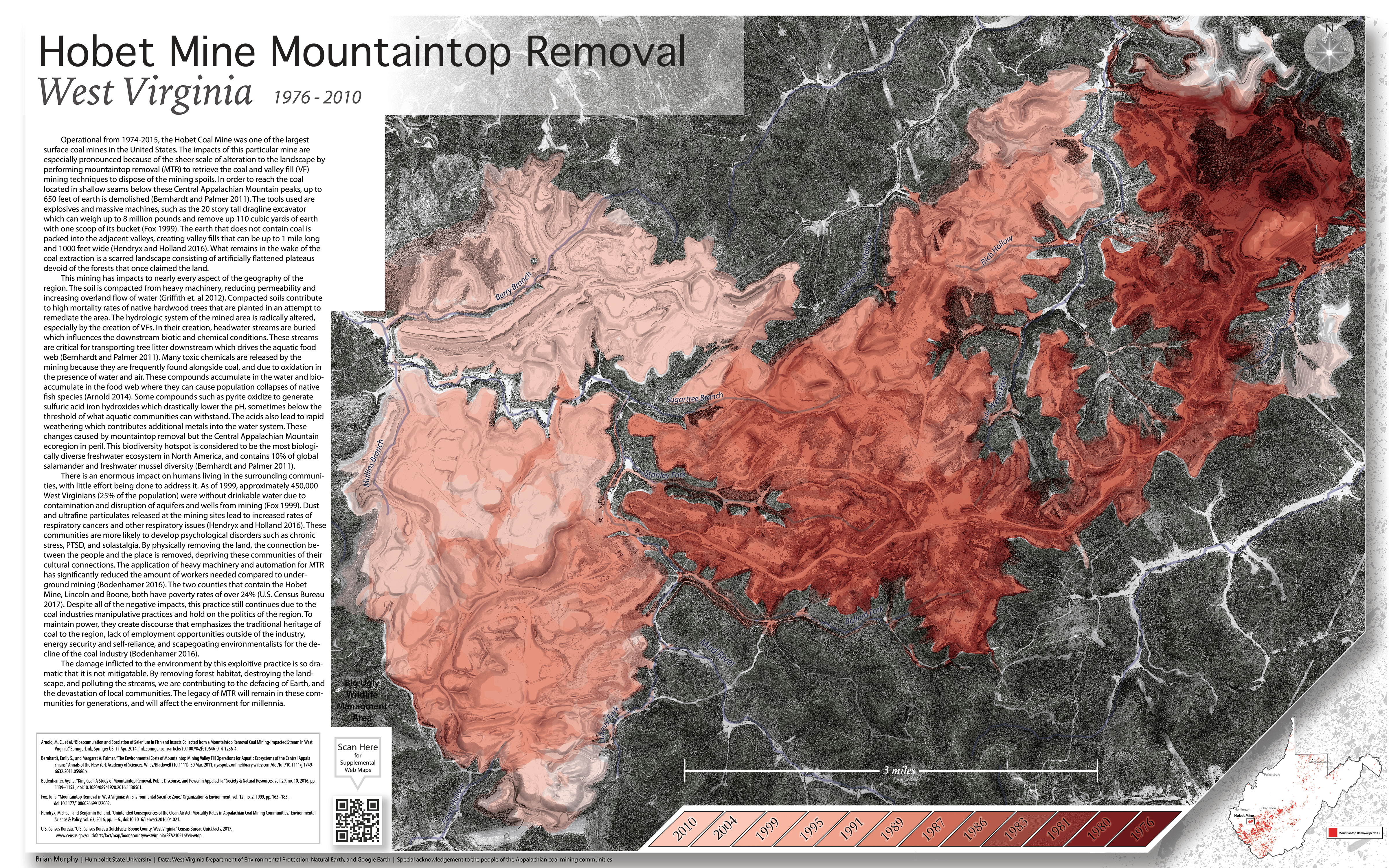
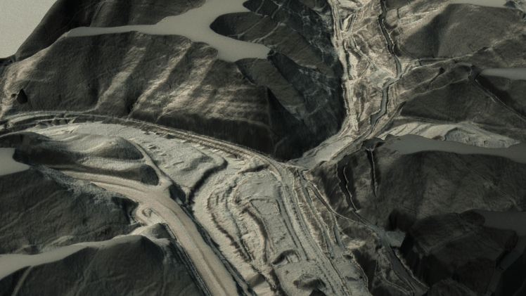
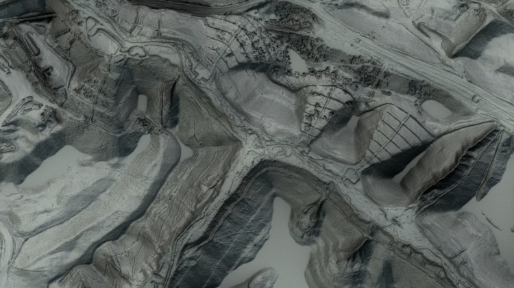
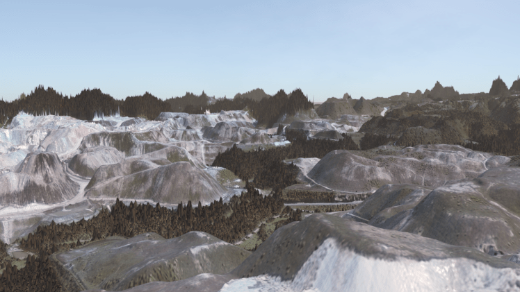
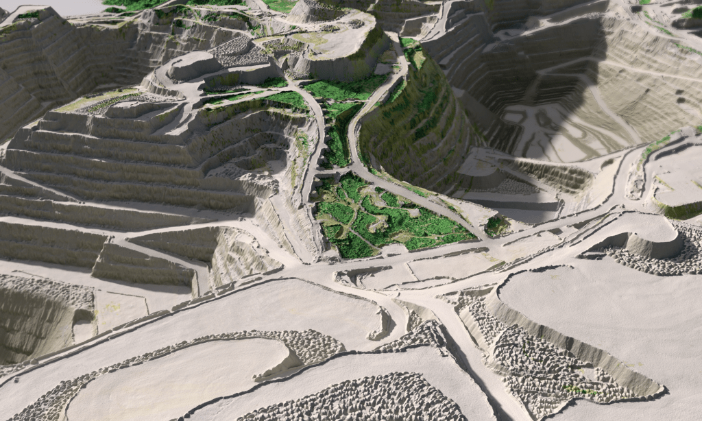
Hobet Mine Mountaintop Removal: 1976 – 2010
2018
Winner of NACIS 2018 Student Research Poster
Published in Humboldt Journal of Social Relations vol. 41
This map was created by combining 3D modeling software with a chronological land change/ land use (LCLU) analysis of the Hobet Mine in southwestern West Virginia. This map shows the relentless and methodical destruction of the landscape for the sake of short term profit. This map has always inspired me to present the stark truth of our environmental reality, and how it directly ties social and economic issues with science. To make a change we need to be aware of what our society is willing to sacrifice to make money.
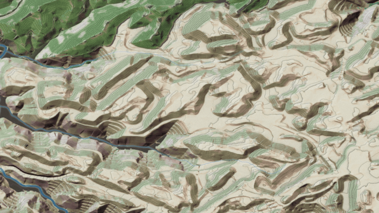
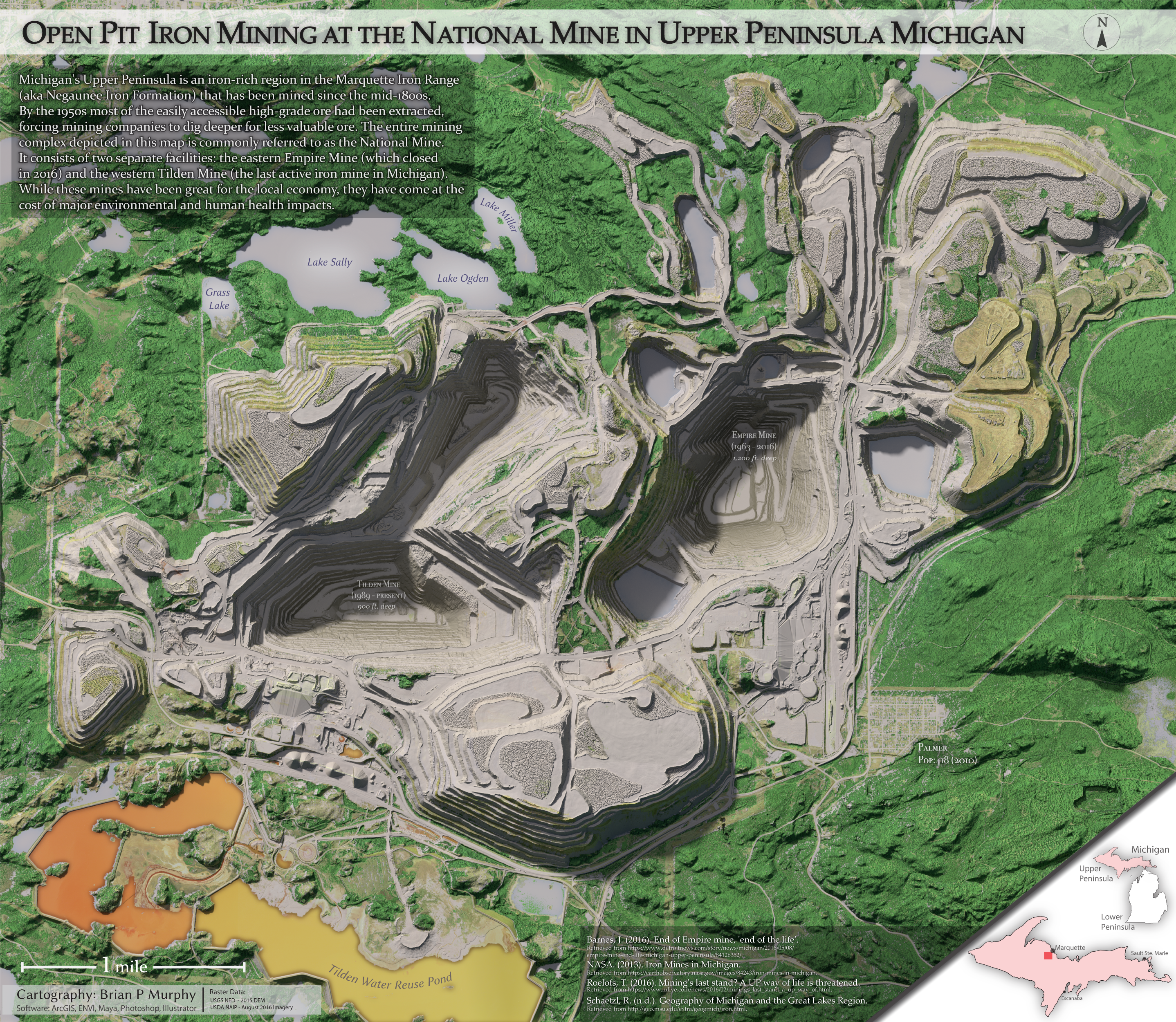
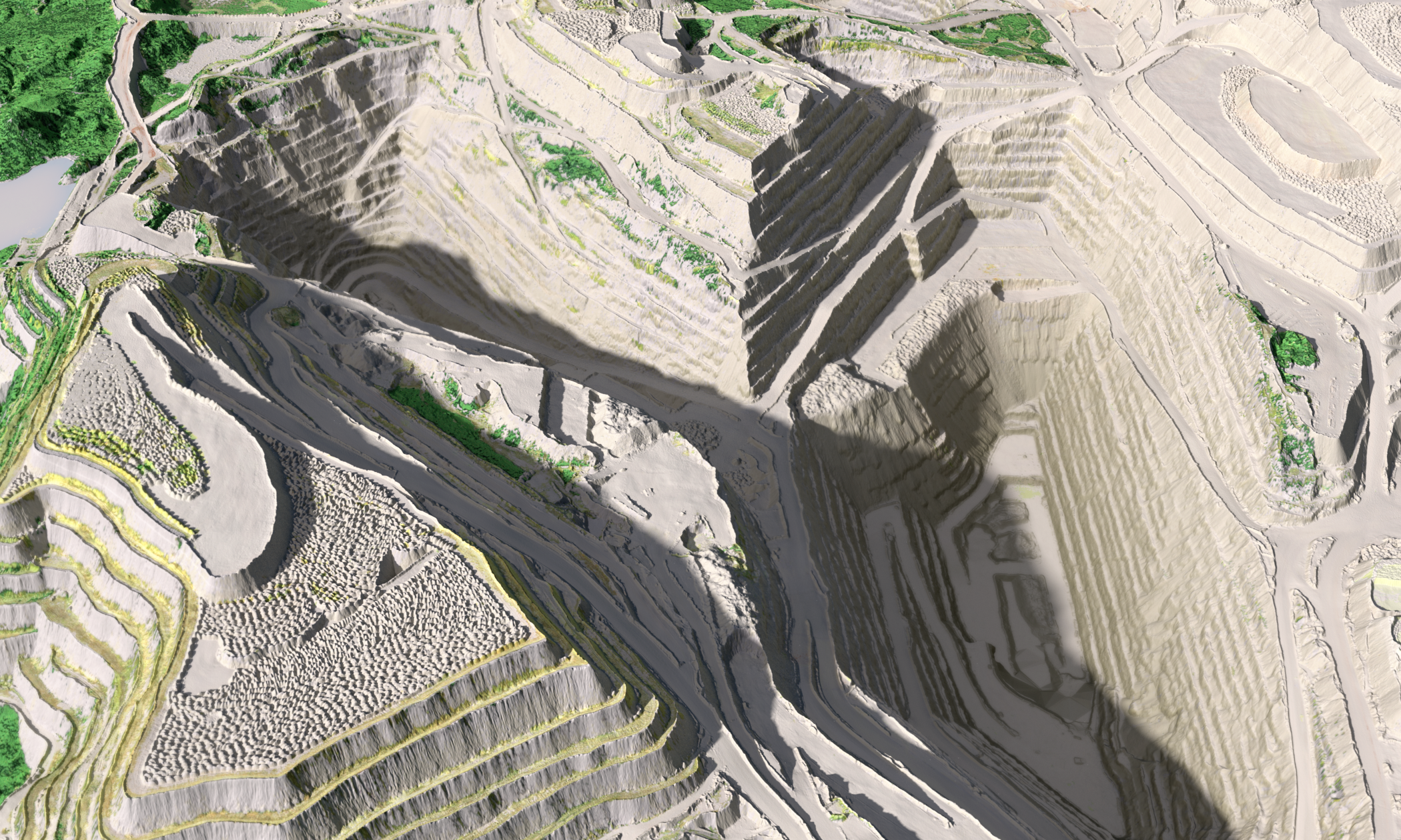
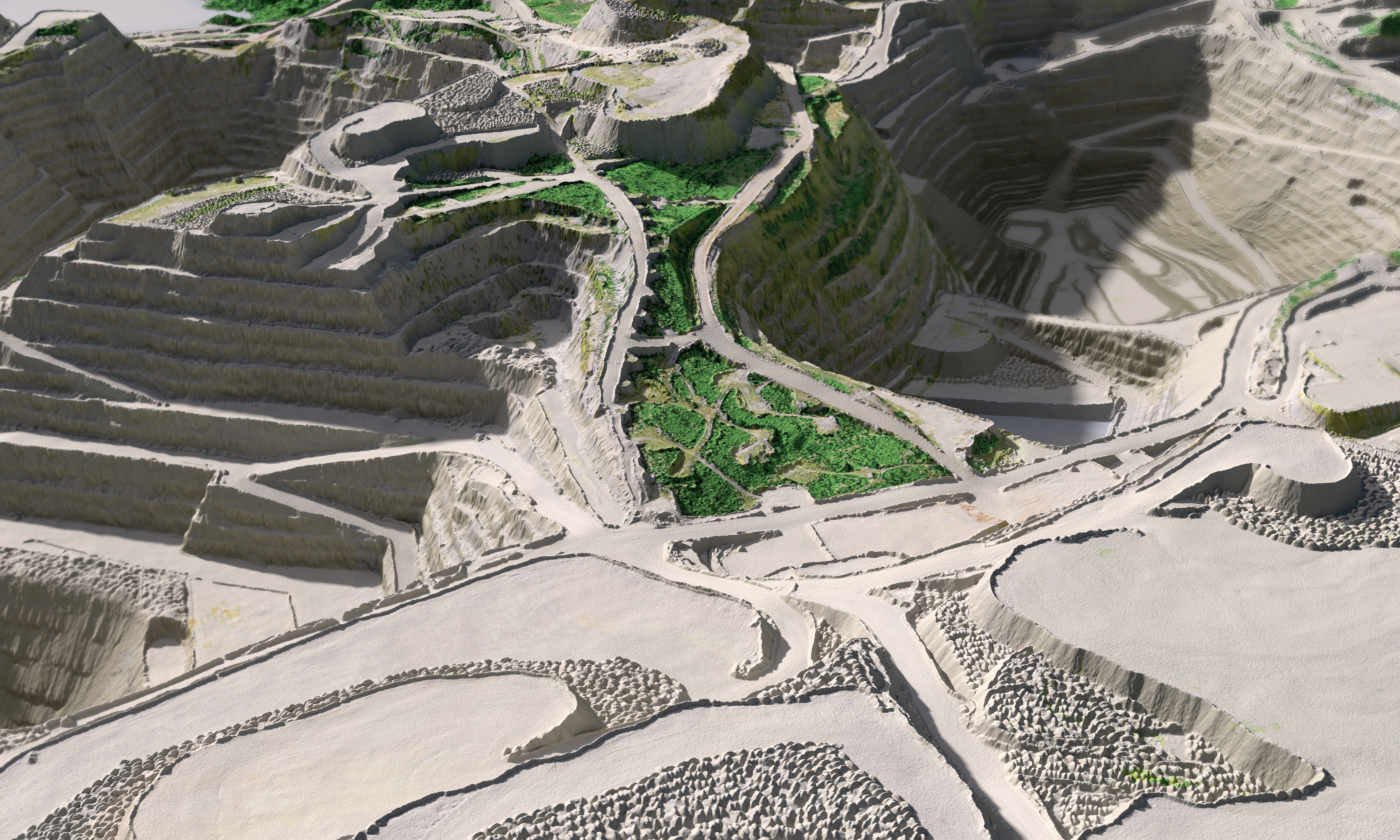
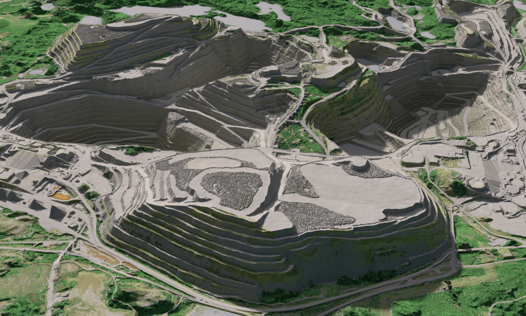
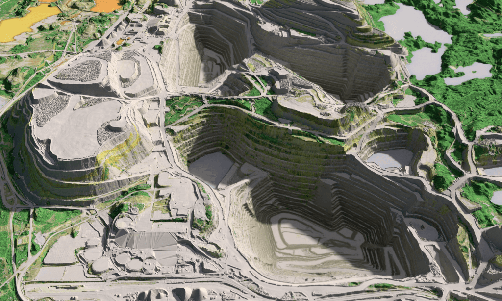
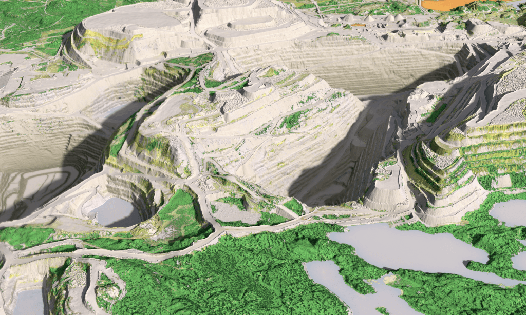
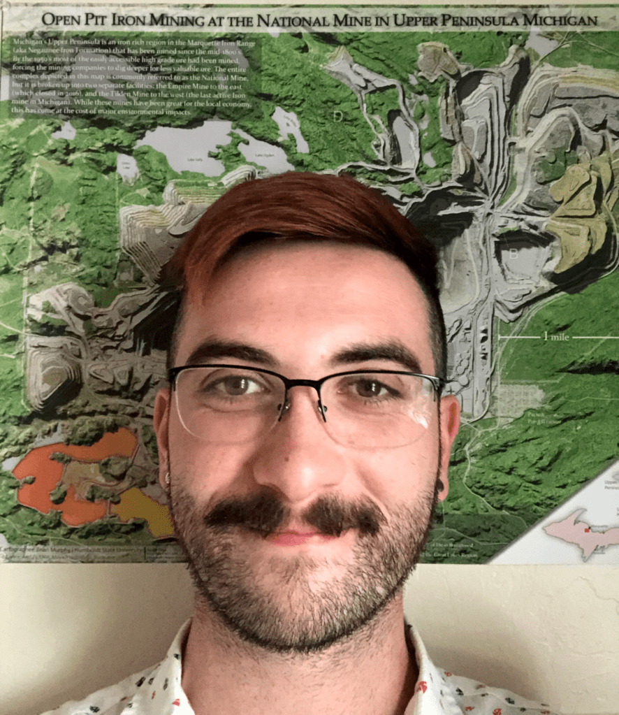
Open Pit Iron Mining at the National Mine in Upper Peninsula Michigan
2019
Featured work for the Humboldt State University GIS Program
Winner of Intermountain GIS 2021 Conference Professional map
The dramatic footprint of many of these surface mines put into context the human impact to the environment. The National Mine complex, which includes the western Empire Mine and eastern Tilden mine, is visible from space. The rust orange tailing ponds stretch miles and appears as two orange lakes southwest of the city of Marquette. The near by town of Palmer is a mere fraction of the size of the size of the National Mine. Not only is there long lasting damage to the terrain and depletion of resources, this extractive process is not economically sustainable. Empire Mine has already closed due to it becoming unprofitable, causing layoffs and economic contractions for the small surrounding towns.


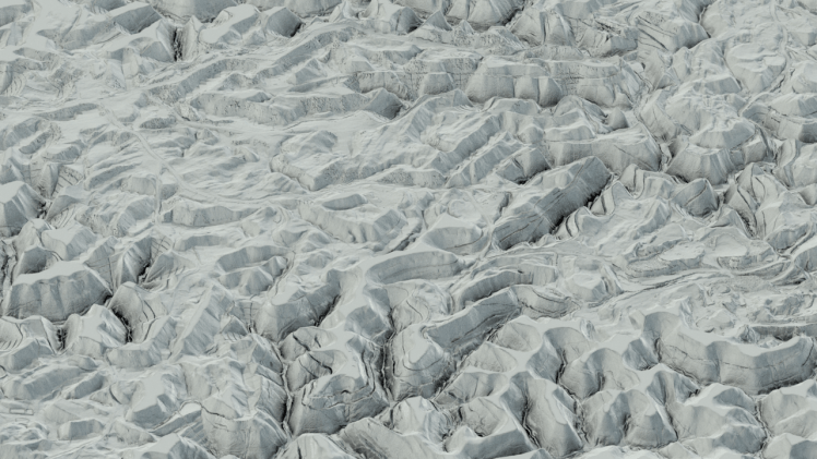
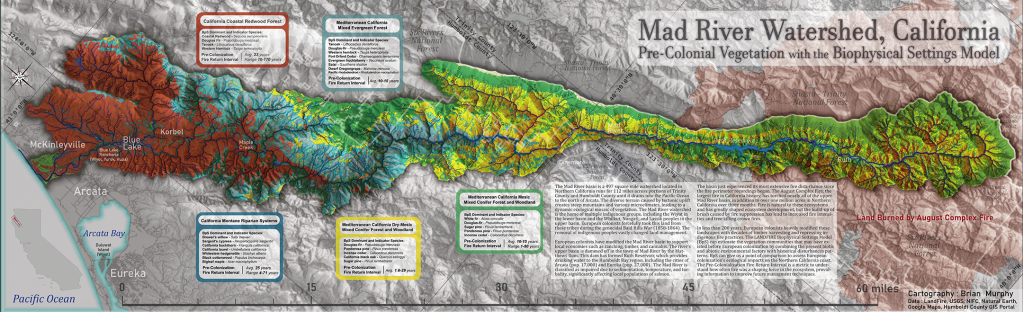
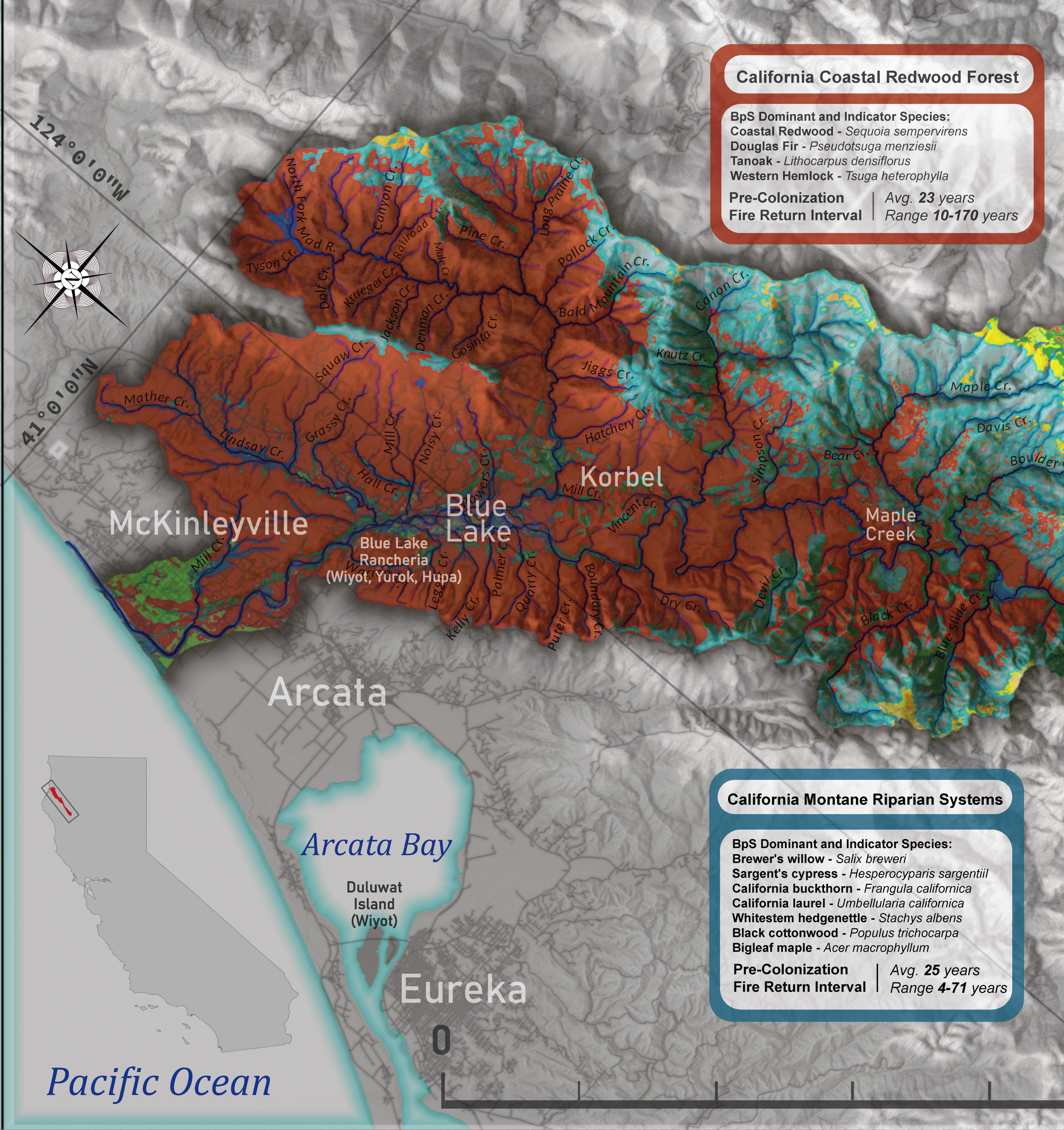
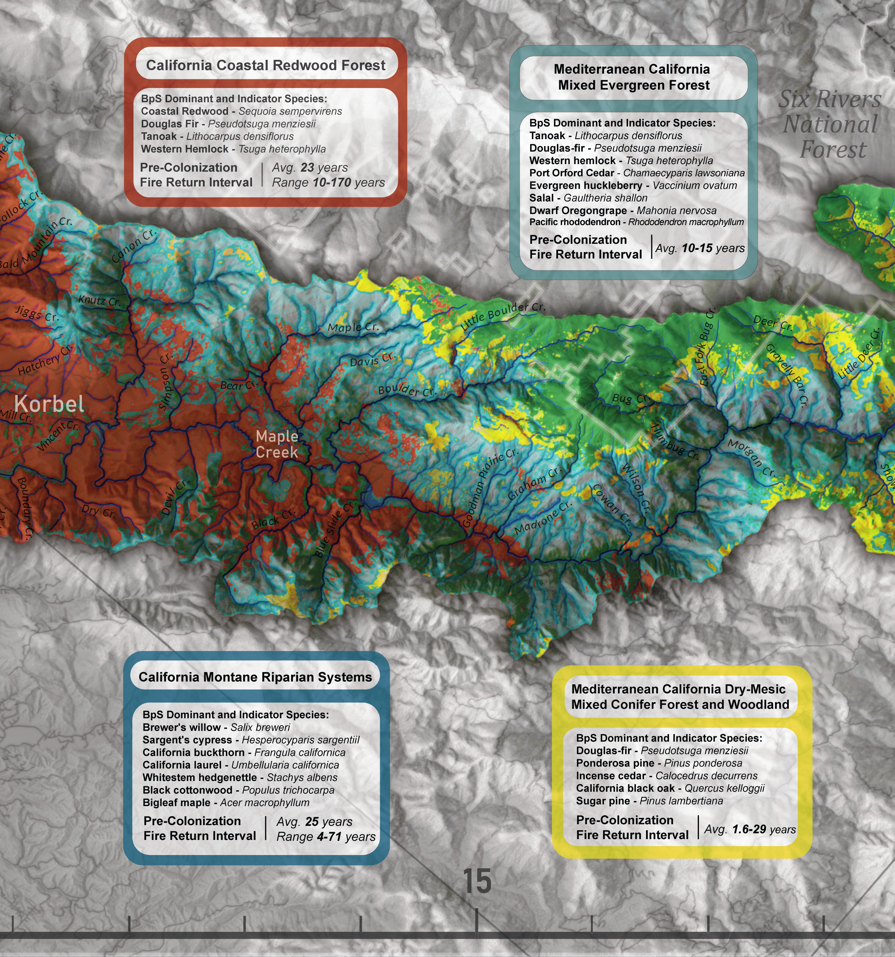
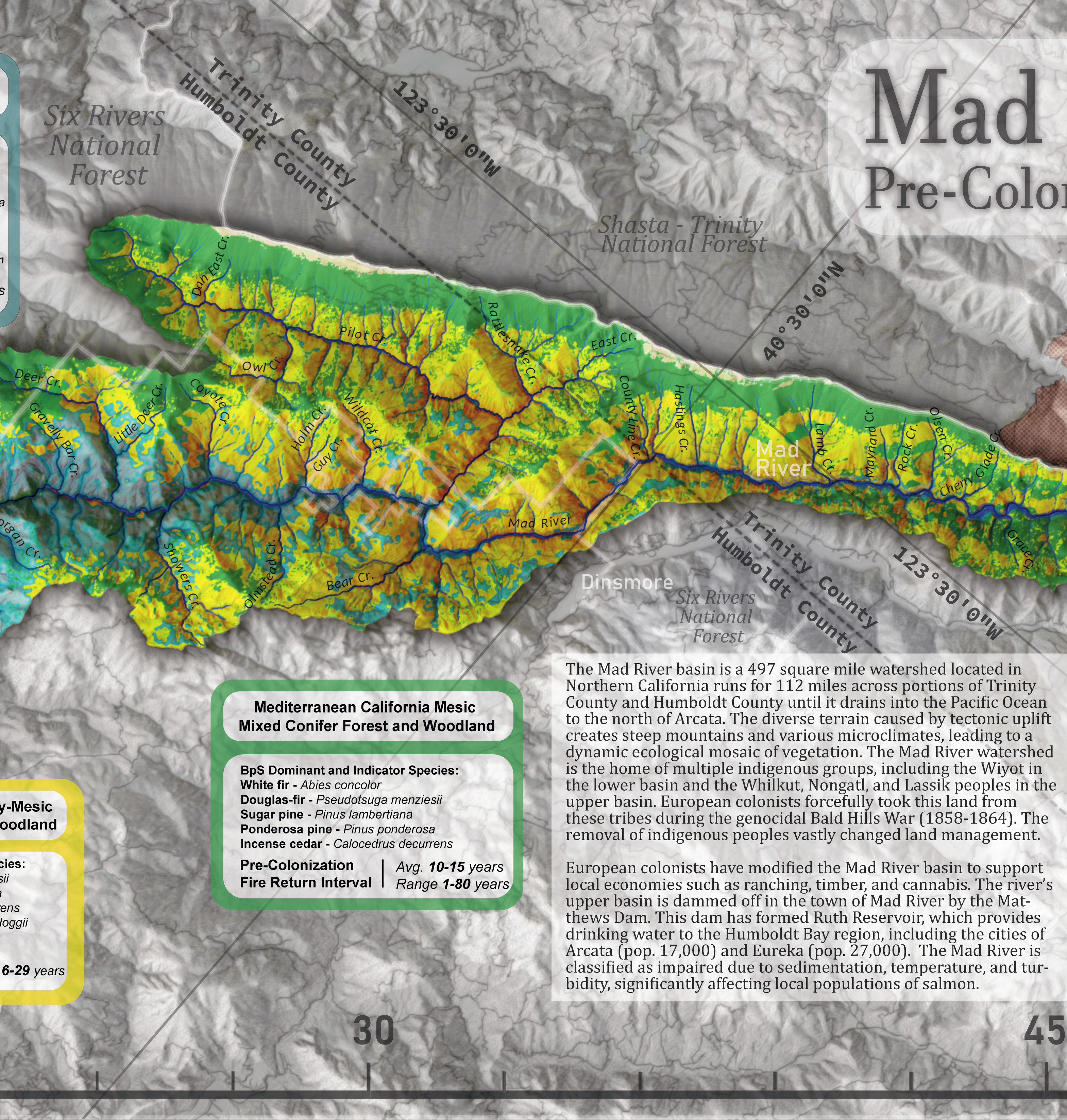
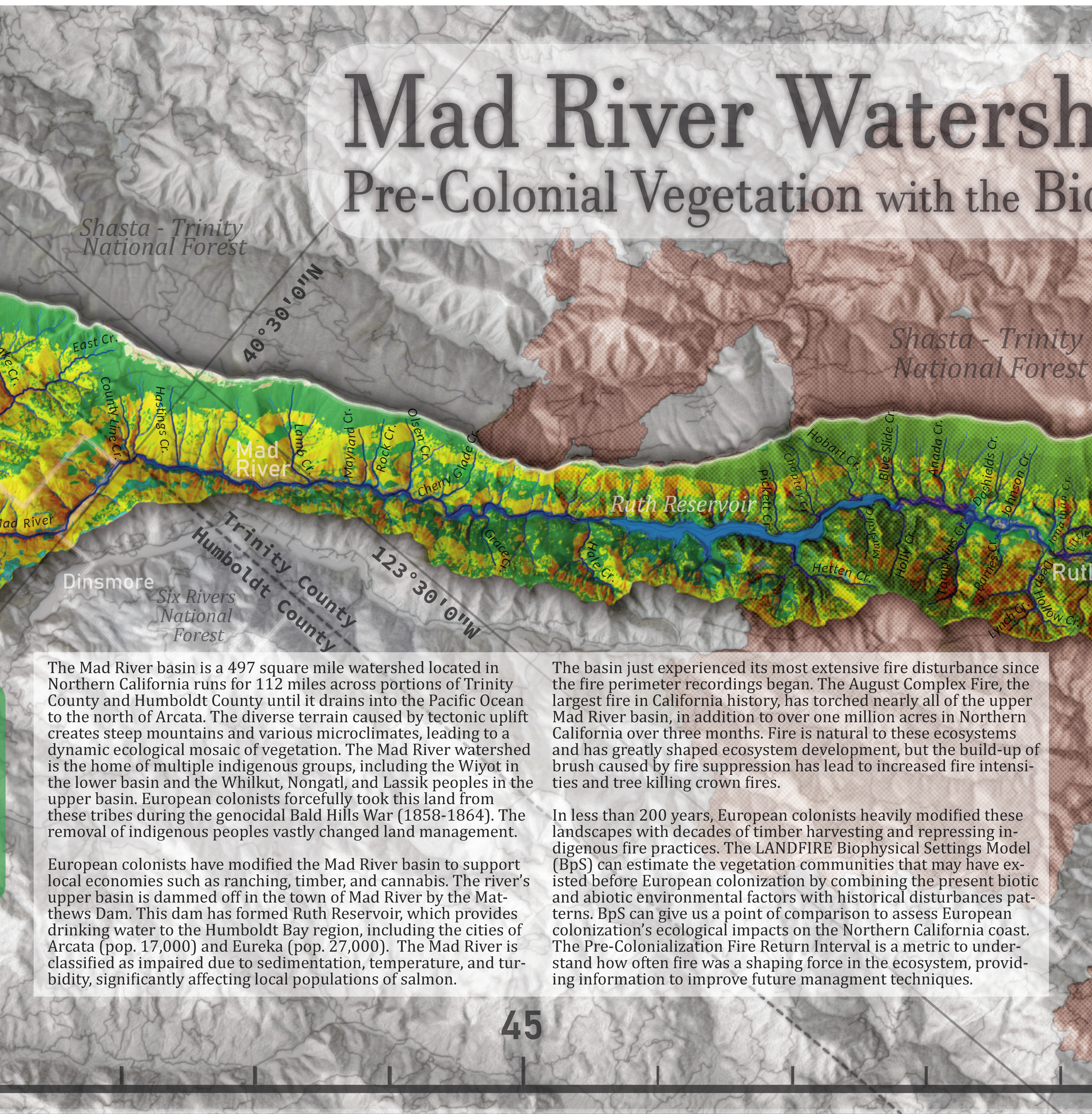
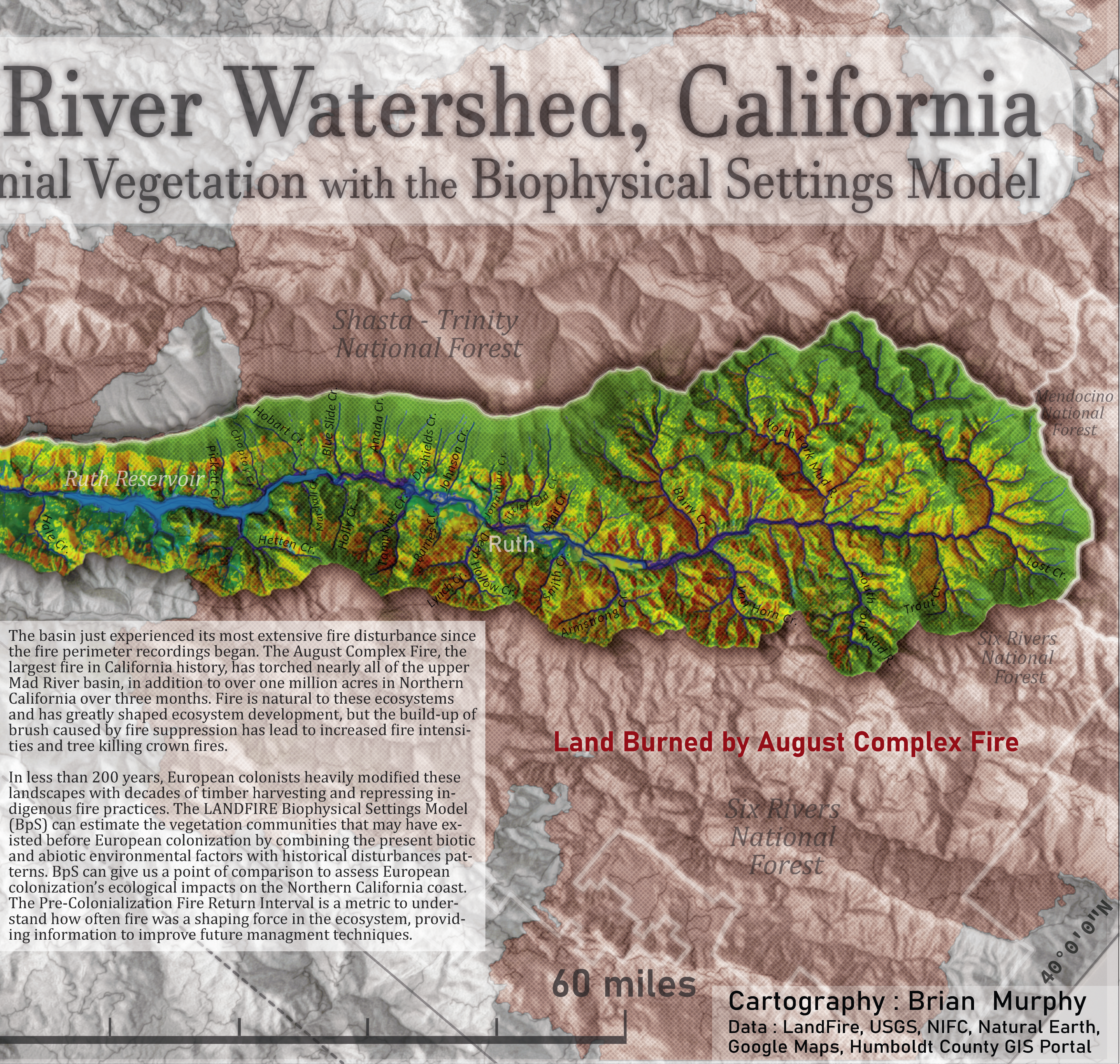
Mad River Watershed, California: Biophysical Settings Model
2020
Featured in the 2020 NACIS digital map gallery
Winner of Analytic Presentation category at ORURISA 2021 GIS in Action map gallery
This map initially began as an ecological assessment of the nearby Mad River watershed, which provides water for the Humboldt Bay region. The biophysical settings is a model of forest composition prior to European colonialism, a relic of conditions that do not exist anymore. Land usage such as timber extraction, as well as fire suppression by forest management policy, and genocidal suppression of indigenous people and fire practices has lead to changes in forest composition. During the production of this map, the August Complex fire became the largest fire in California history and spanning over one million acres, burning for 88 days between August and November. The scale and intensity of this fire is a testament to how powerful human land management practices can be to the changing the fire regime.
Additional Cartography
2018
These maps were created in Advanced Cartography class at Humboldt State University. I would like to thank my cartography advisors Dr. Amy Rock, Dr. Nick Perdue, and Aaron Taveras for providing support and advice for my maps, as well as encouraging me to attempt new techniques and apply my skills.


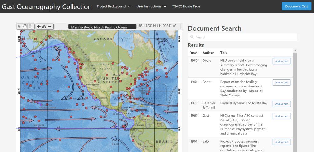
Web Cartography
2020
Interactive document searching tool is available here
This map is a geolibrary that contains decades of oceanography research from the personal collections of Humboldt State University Professor Dr. James Avery Gast and University of Washington Professor Dr. Tommy Thompson. This map and the document ordering system were created while employed at Thomas Gast & Associates Environmental Consultants.
Science and Art intersecting with Geography
I have had the opportunity to with multiple academic institutions and consulting firms to tackle environmental and infrastructure issues with cutting-edge GIS modeling and high quality 3D enhanced graphics.
Graduated from HSU
2019
GIS Conferences
5
Bachelors of Science GPA
3.51
Associates Degrees
3
About Brian.
Brian Pellican Murphy is a remote sensing and cartography specialist who has performed GIS work across the across the west coast of the USA, for both federal government and private industry. He has worked in a variety of GIS positions from doing project management and drone flights to complex spatial modeling and coding. He lives in Portland, Oregon and enjoys outdoor painting and mapping out his spring garden.
Read about my current geospatial and 3D visualization projects on my Blog!
